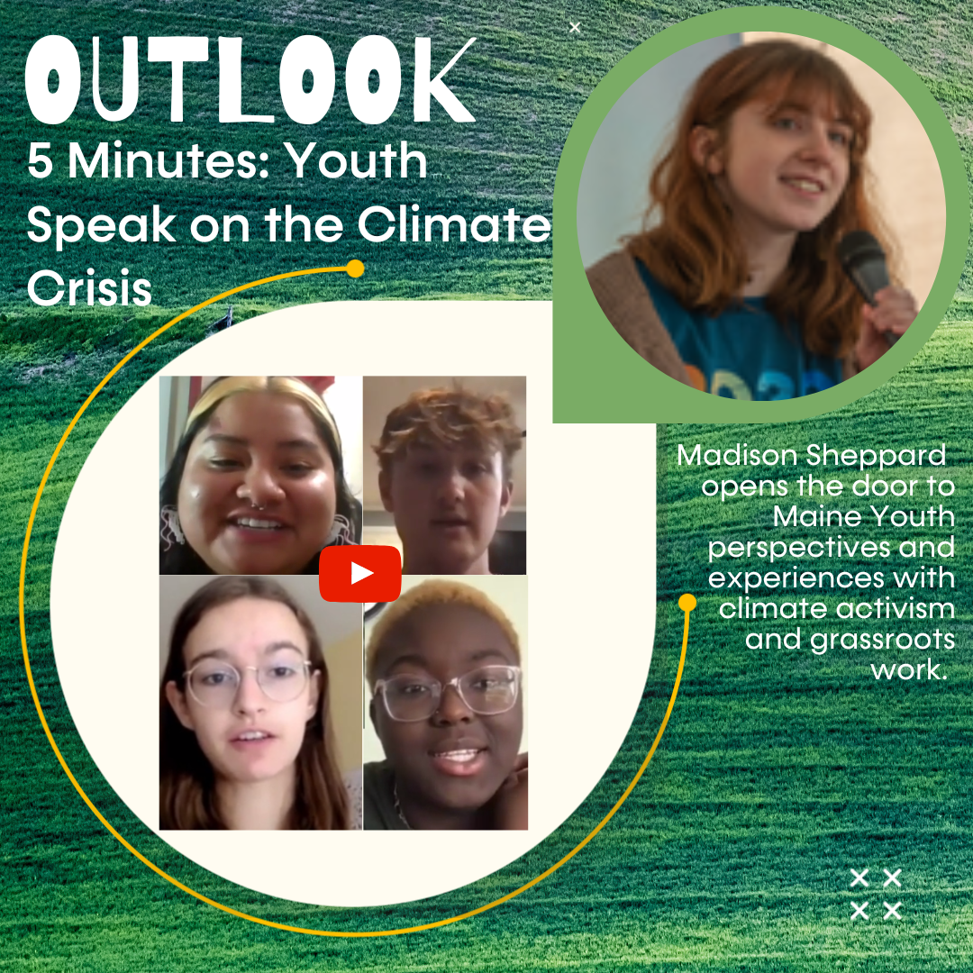
OUTLOOK: 5 Minutes: Youth Speak on the Climate Crisis by Madison Sheppard
In this 5 minute video presentation, Madison Sheppard, Southern Maine Conservation Collaborative & MEEA Summer Associate, opens the floor to Maine youth perspectives and experiences with climate activism and grassroots work. From young people’s point of view, we answer the important question, “Why is it important for youth to be part of the climate movement?”
As I ease into the final week of my internship with Southern Maine Conservation Collaborative and Maine Environmental Education Association, I can’t help but reflect on the wealth of experiences I’ve gained while surrounded by such welcoming, caring, and encouraging folks. One of which has been contributing to the OUTLOOK story series. OUTLOOK explores variables that shape and influence individuals’ relationships with nature and how they seek to inspire, adapt and reimagine what conservation can look like moving forward in a world where Climate Change is affecting a broad range of human and natural systems. Through this experience, I was fortunate enough to spend time with several folks, each with their own unique relationships with climate change, but all invariably affected by its ever-growing impacts. To illustrate these differences and similarities, as well as to bring some closure to my time here, I figured it might be fun to incorporate a couple of my interviewees perspectives into one post. Enjoy 🙂
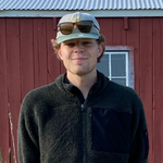
Natalie Meenan
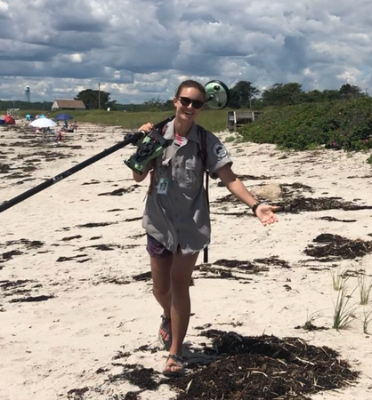
For Natalie Meenan, climate change manifests as an everyday lived reality that she’s reminded of through her time in the natural world. As someone who grew up leading kayaking tours on the San Juan Islands in Washington, and is most recently involved in on-the-ground beach surveying with the Maine Geological Survey, she’s almost always outdoors. It’s her tangible contact with things like beach erosion, sea level rise, and encroaching invasive species that characterize her associations with climate change as something visible and unwaveringly present. For her, this may stir up an “existential dread of what else climate change has in store for the world,” but it also serves as an ever-present driver in her environmental work, and the motivational building block to play her role in fighting climate change.
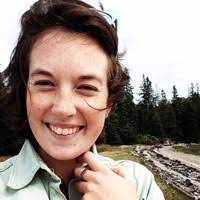
Margaret Gerber
Margaret Gerber, the seasoned Director of Stewardship at the Brunswick-Topsham Land Trust, shares a very similar relationship to climate change as Natalie. She noted the importance of having face-to-face contact with the beauty of the natural world, as well as exposure to how climate change is shifting the development and inner workings of our environments. When she was fortunate enough to visit ice sheets in Greenland as a college student, she developed a “powerfully visceral connection” to natural spaces, a feeling noticeably akin to Natalie’s. Yet she maintains her own unique approach to tackling climate change through the land trust model, working to protect land in perpetuity to provide recreational and educational opportunities for anyone to learn about climate change.
Bill Stauffer
When speaking with Bill Stauffer, Vice President of the Oceanside Conservation Trust of Casco Bay, it was clear that his connection to climate change was deeply personal. Living year-round on an island, he is surrounded by the impacts of sea level rise, erosion, and increased storm events. As he noted in our interview, “We have witnessed intensified storm surges that erode the banks more every year.” His work with OCT thus also becomes rather personal, where he emphasizes the importance of preserving island properties for future generations of wildlife, as well as for their unique importance to climate change research.
Madeline Tripp, Environmental Resilience Fellow with the Greater Portland Council of Governments, is on the other end of the research that Bill wishes to facilitate. As the developer of the Community Intertidal Data Portal, Madeline committed herself to pooling research data, particularly shellfish data from the intertidal zone, into formats that are more easily accessible to everyday users. It’s through this work that Madeline plays her own role in confronting climate change. She mentioned in our talk that tackling climate change must be rooted in collaborative processes, “We need to stress the importance of sharing information and resources between Maine communities.”
Maranda Nemeth
My final interviewee, Maranda Nemeth, similarly noted the importance of organizational cooperation as a key factor in the fight against climate change. Her work as the Project Manager overseeing the removal of Walton’s Mill Dam with the Atlantic Salmon Federation depends enormously on the contributions of the project’s partners. Removing a 300 foot dam to open up nearly 53 miles of habitat to the endangered Atlantic salmon can’t be done alone! She also shed light on the significance of rewilding what were once manufactured spaces in our path to fight climate change. The dam removal project is a perfect example, and one she understandably prides herself in being a part of.
My hope is that my conversation takeaways above highlight the interesting dynamics at play with climate change. We are all affected by it, and may share similar ways of tackling or confronting environmental hazards, but as a consequence of our backgrounds, interests, and professions we may process and feel the impacts of climate change very differently. We may react differently. And we may think differently. Yet, threaded into all of my conversations was the undergirding motivation to act together.
This story series resurfaced some of my own feelings of hope for the future by providing glimpses into the lives of people working extremely hard to protect the world around them. I’ve learned that there is value in providing spaces for people to share their perspectives. Even if it may be through a small story series like OUTLOOK, these spaces foster safe environments for people to teach, motivate, and learn. As a young person, I am fully aware that other young folks may not always have these opportunities for their voices to be amplified, making pieces of this project that much more meaningful to me. Similar to the development of Madeline Tripp’s Community Intertidal Data Portal, I hope to see the OUTLOOK series grow larger into a repository of change-making ideas to be shared and scaled across communities. Then, maybe these ideas will translate to on-the-ground work done by people like Natalie, Margaret, and Maranda. Or maybe they’ll inspire work to protect and preserve island properties as Bill does. Regardless of the outcome, these ideas should be shared, and I couldn’t be happier to have facilitated people in sharing their own stories. Hopefully, you feel inspired to do the same!
Outlook explores variables that shape and influence individuals relationships with nature and how they seek to inspire, adapt and reimagine what conservation can look like moving forward in a world where Climate Change is affecting a broad range of human and natural systems.
Author: Chas Van Damme, SMCC Summer Associate. A rising senior at Bates College studying Environmental Studies with a focus in Global Environmental Politics.
OUTLOOK: A Climate Change Observatory site installation with Caitlyn Hanley, intern at the Falmouth Land Trust and Chas Van Damme, summer associate SMCC & MEEA.
There’s a joy-ridden emotion I often find myself chasing, one that surfaces only after heavy exertion, after struggle, never after ease. It’s a funky feeling that I’ve come to love, and one that I recently reacquainted myself with last week.
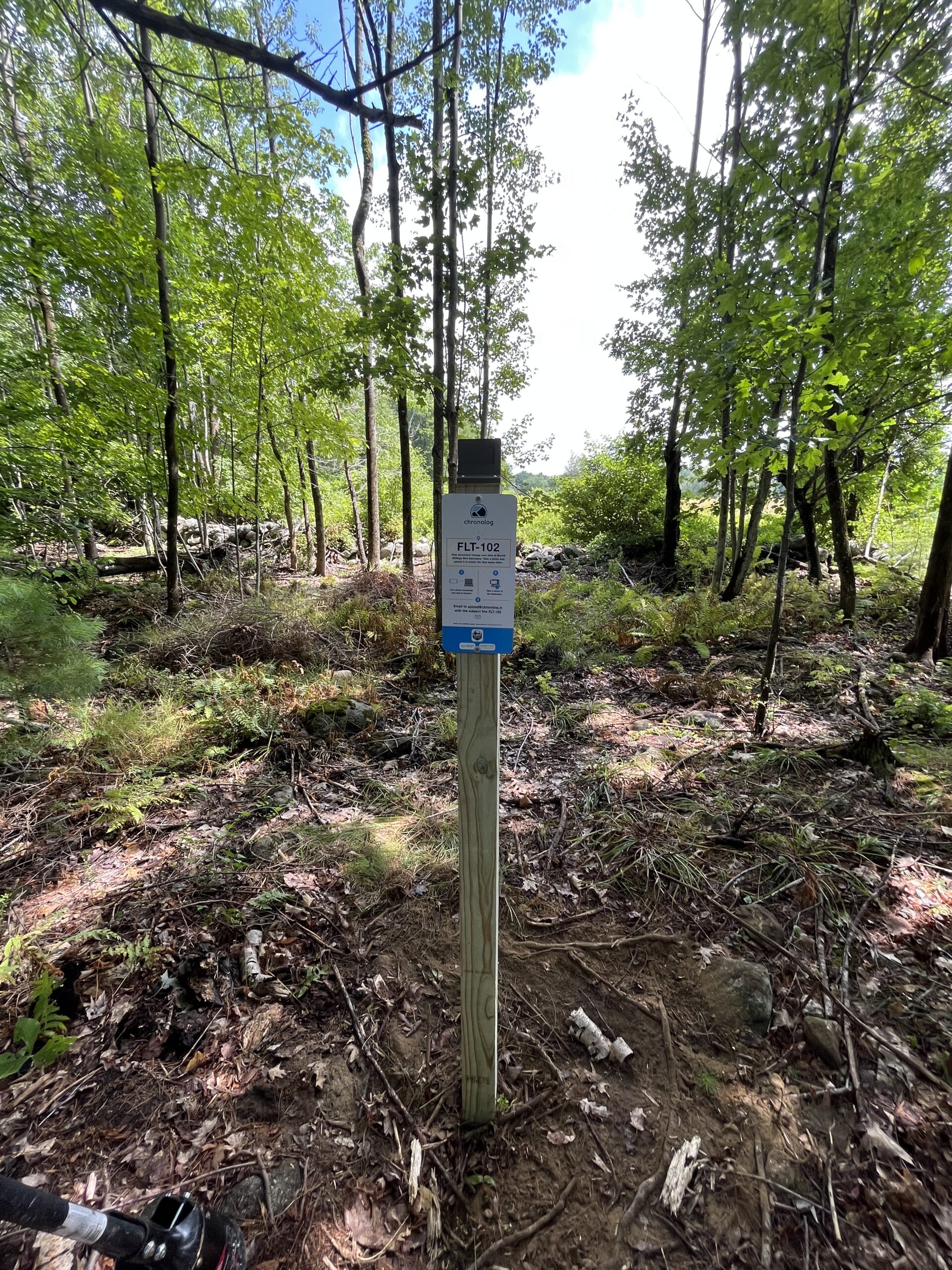
On a hot, muggy day, with a lack of bug spray and nothing but rain and sweat forecasted for your afternoon, is there anything you would want to do more than dig some holes in the woods? I know my answer, and it’s probably a little different from yours. I was thrilled about the opportunity to install a new Climate Change Observatory (CCO) post at Morrill Stillings Bird Sanctuary in Falmouth last week, and so was the incredible Caitlyn Hanley, an intern for the Falmouth Land Trust, who I was fortunate enough to join on this adventure. As a fellow student at Bates College, Caitlyn is studying Environmental Studies and working as an organizing intern for Defend Our Health, where she helps lead the charge to promote equitable access to safe and healthy drinking water. She is especially interested in exploring sustainable agricultural systems and the impacts climate change is having on these systems.
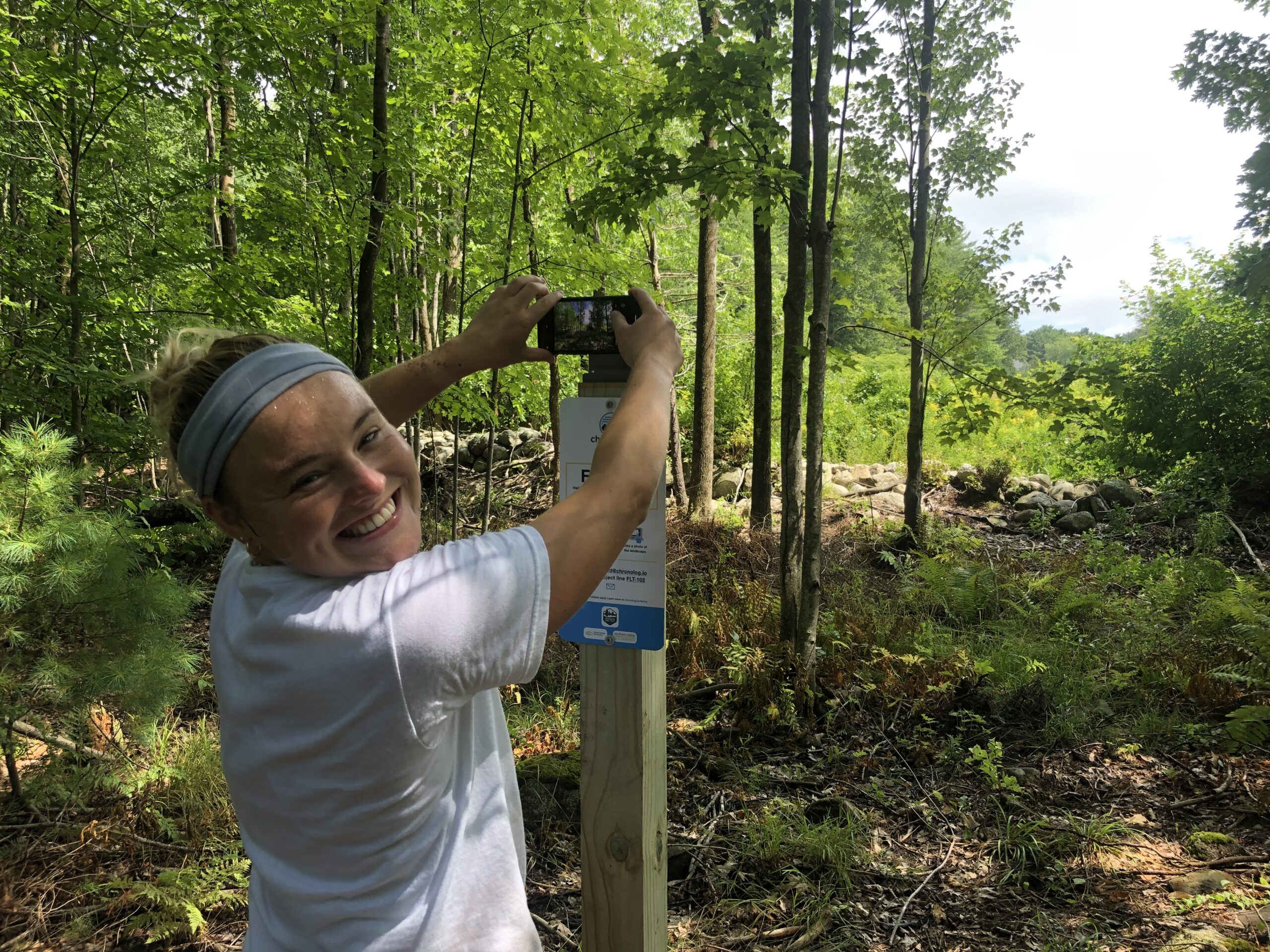
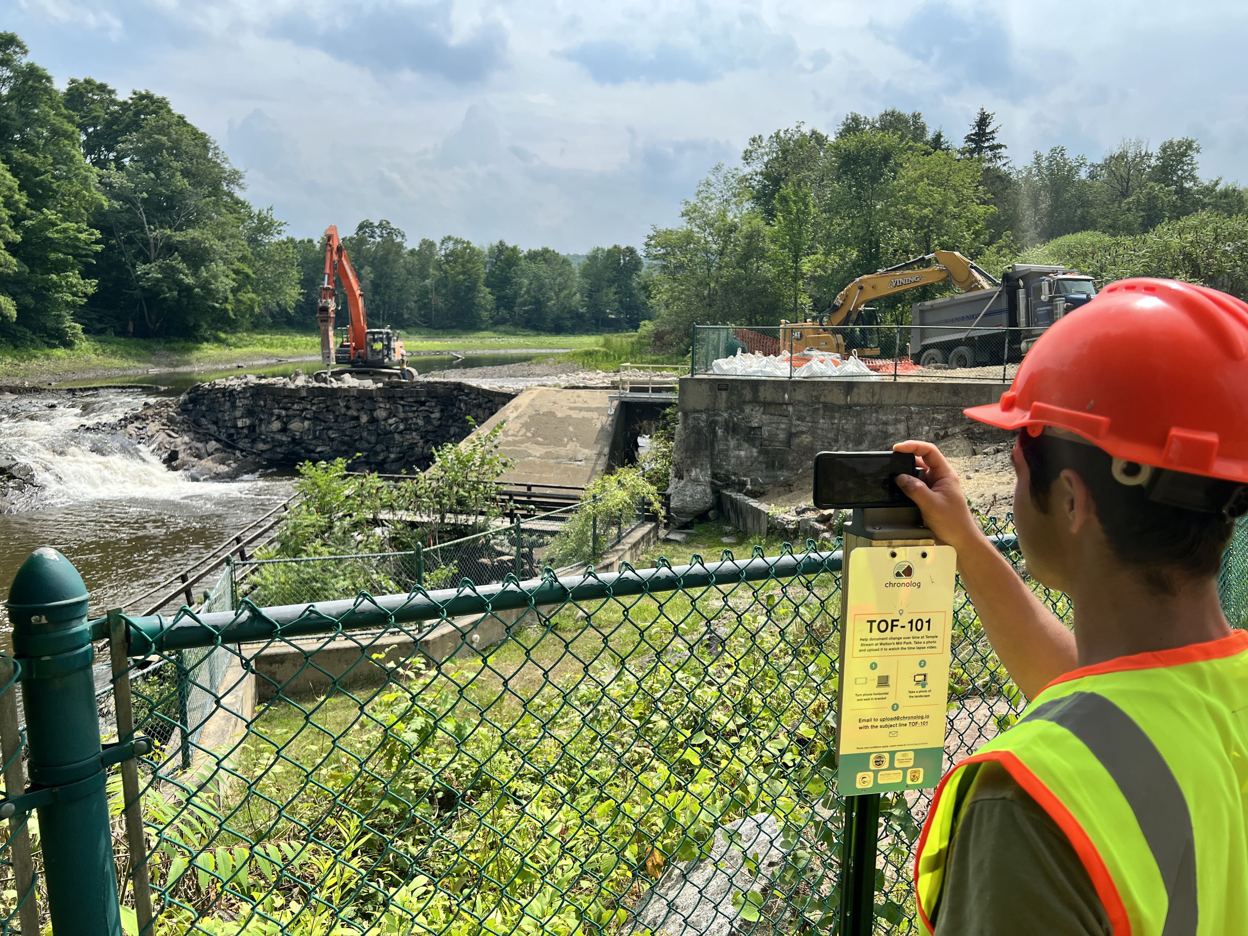
If you haven’t heard of the Climate Change Observatory Network, it is a photo monitoring program designed to work with environmental organizations and communities to assist with the observation, measurement, and documentation of long-term climate change trends, and climate adaptation projects. CCO sites are installed all over the state of Maine and are very easy to use. Simply place your cellphone on the photo bracket at the CCO site post, take a picture and upload it to the Chronolog. The photo is instantly placed into a time-lapse alongside pictures taken by other folks at that location, allowing you to view the changes in environment over time. Caitlyn and I had the job to install a new site to add to this growing observatory network and that, of course, meant digging holes!
Caitlyn Hanley using the newly-installed FLT CCO site at Morrill-Stillings Bird Sanctuary.
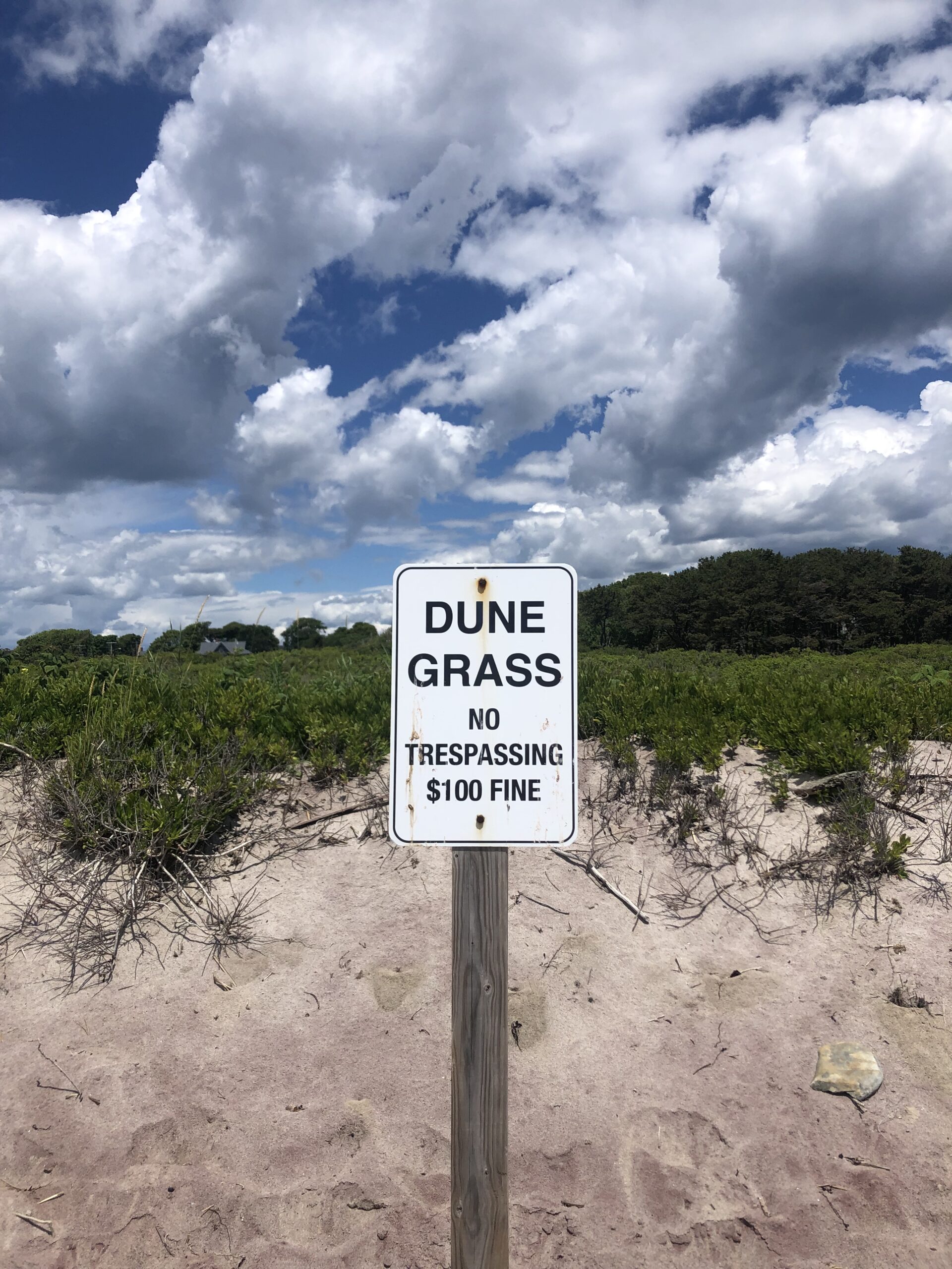
For our hole-digging adventure, Caitlyn had scouted out a spot next on the Fraxinus trail network overlooking the Bobolink Meadow, the home to a number of Tree Swallows and Bluebirds. FLT decided this was the perfect location to place a CCO site to capture the gradual change in the meadow environment over time. The location also features some invasive plant species in its view, and will monitor ongoing work to remove and manage them in order to restore native plants to create a healthy ecosystem. It was at this set-up location that Caitlyn and I found ourselves working toward that funky feeling I noted earlier.
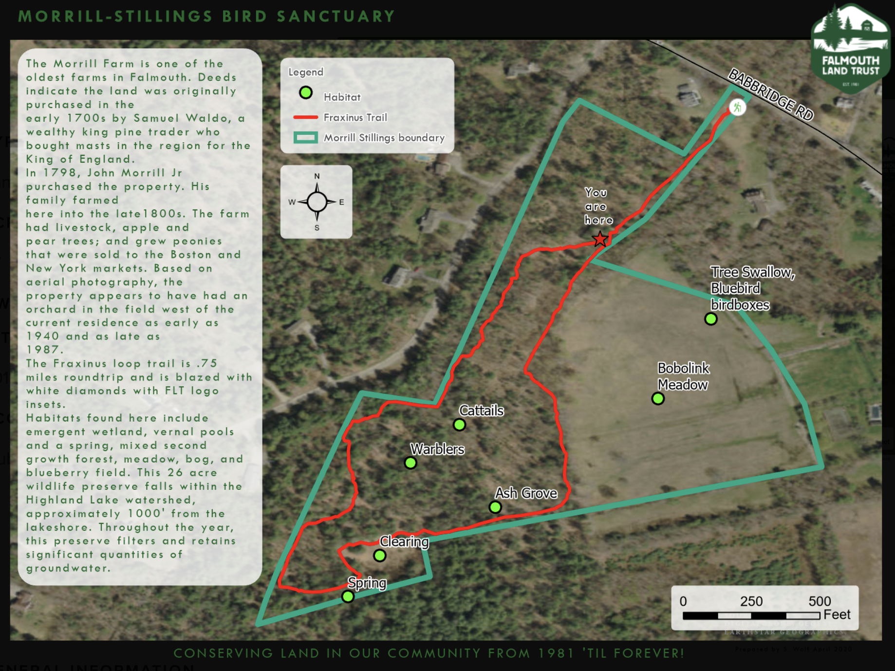
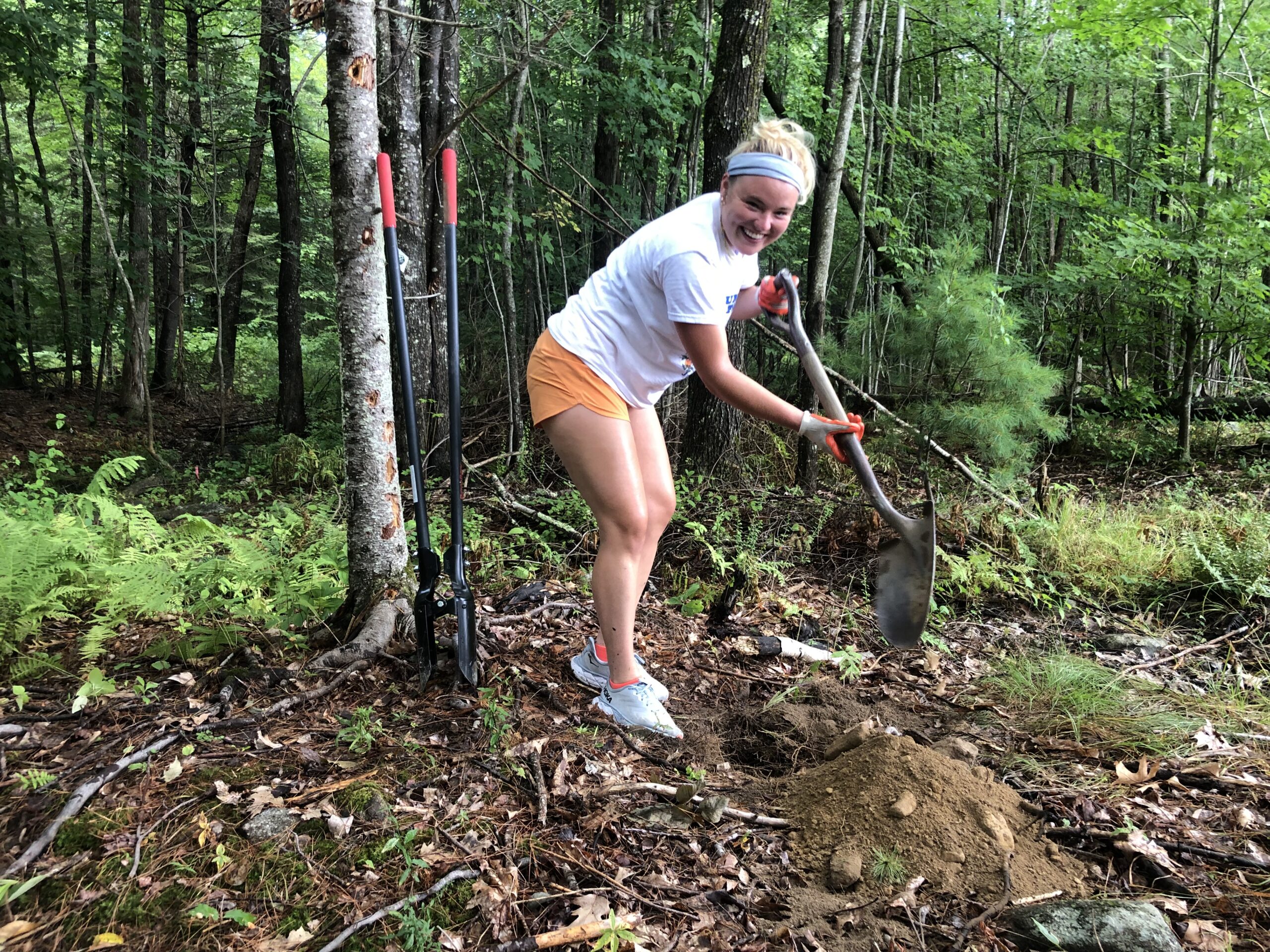
Trail Map of Morrill-Stillings Bird Sanctuary.Caitlyn breaking ground on the site!
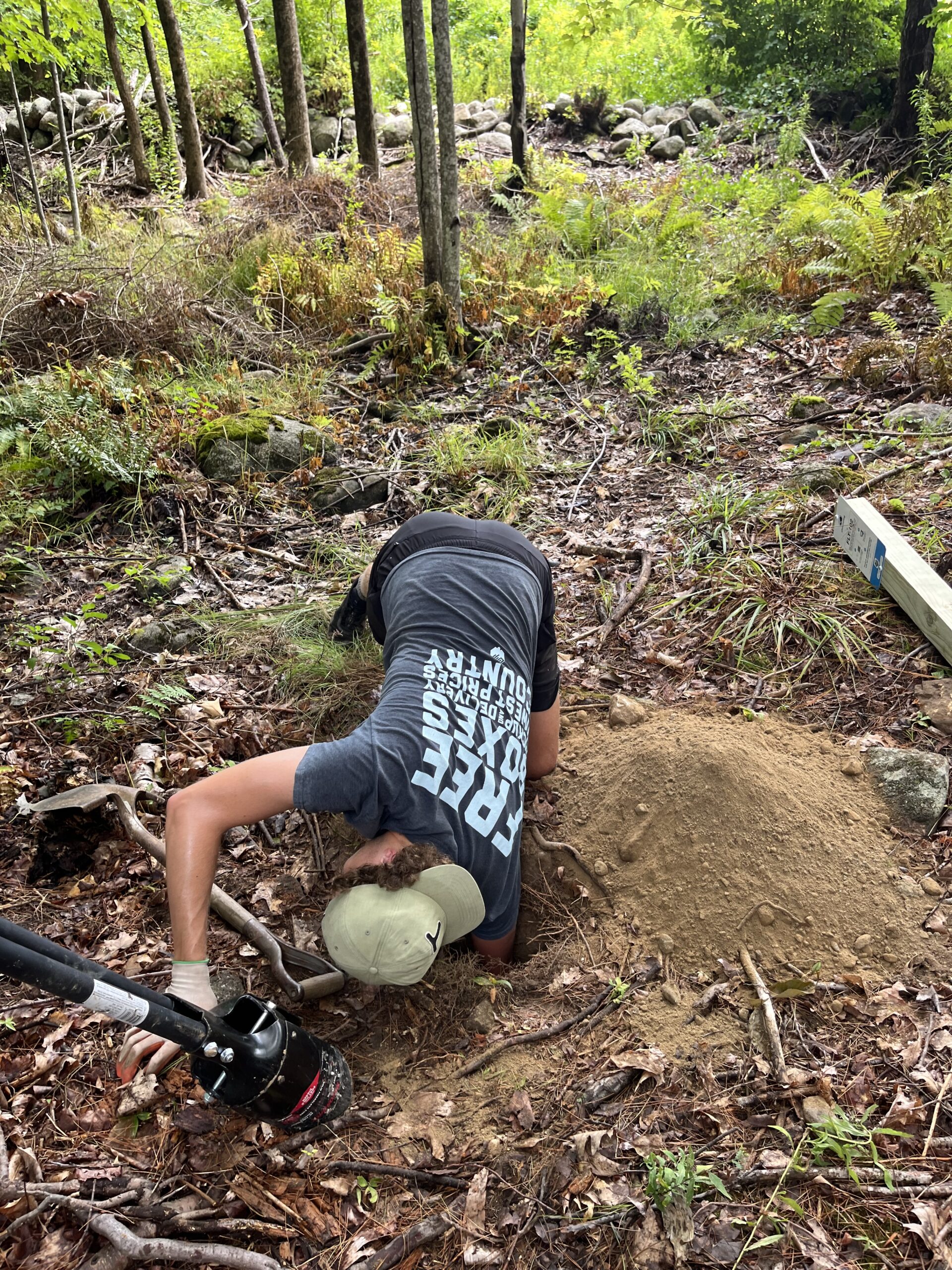
We had lugged in the 8 foot post, a pair of shovels, and a post-hole digger – well-prepared to start digging. To our surprise, however, putting a post in is a lot harder than it looks. Old root systems, large rocks, and little critters meant we had to take a couple detours into the ground. Careful not to damage the sensitive soil and understory, we made sure to dig slowly, maneuvering gingerly around the tree roots and taking plenty of water breaks. As we switched off with the tools and ping-ponged complaints about the weather and bugs, we couldn’t help but share a couple laughs. Yet this would only mean that funky feeling of joy would hit a little harder once we were done. After 3 feet of digging, we put the post in, oriented it in the best direction, and packed the remaining dirt in. It was perfect timing as rain began to sprinkle over us and it only took a little more work screwing in the Chronolog stand above the post to call it quits. We were done!
Hand-scooping the dirt proved to be more efficient than the post-hole diggers after you’re a couple feet below the surface.The Climate Change Observatory post we installed. The site will be launched in the coming weeks.
We had installed a post hopefully sturdy enough to stand for years to come, allowing anyone with a phone to help monitor and capture the gradual changes of this lovely little nook in the Falmouth woods. I’m thrilled to have been able to play a role in the CCO network with this install. It’s truly fascinating to see how projects like this come together and can be a tool to help land trusts and communities better understand environmental changes occurring over time and offer support for making more informed management and adaptation decisions. Thanks for a great experience, Caitlyn!
Outlook explores variables that shape and influence individuals relationships with nature and how they seek to inspire, adapt and reimagine what conservation can look like moving forward in a world where Climate Change is affecting a broad range of human and natural systems.
Author: Chas Van Damme, SMCC Summer Associate. A rising senior at Bates College studying Environmental Studies with a focus in Global Environmental Politics.
OUTLOOK: A chat with Maranda Nemeth, Maine Headwaters Project Manager, Atlantic Salmon Federation
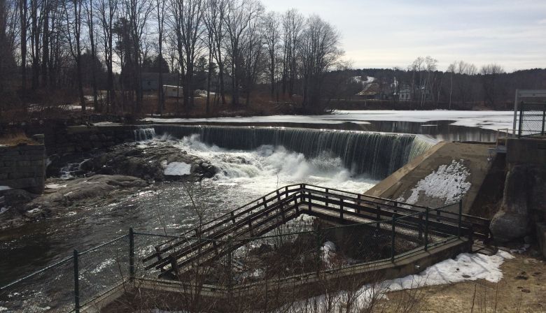
Dams have long been controversial structures. They, on the one hand, have the potential to provide clean energy through hydroelectric means, ensure adequate water supplies for irrigation, prevent flooding, etc. On the other hand, what are often the older, more derelict dams have the potential to become infrastructural hazards, barriers to fish migration, obstructions for natural sediment flow, the list goes on. This is why I’ve always been fascinated by the idea of removing a dam. It’s an ironic process of rewilding – of using human intervention to undo a previous human intervention and revitalize what we’ve deemed to be “natural.”
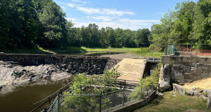
Walton’s Mill Dam prior to its removal. (photo courtesy of Atlantic Salmon Federation)
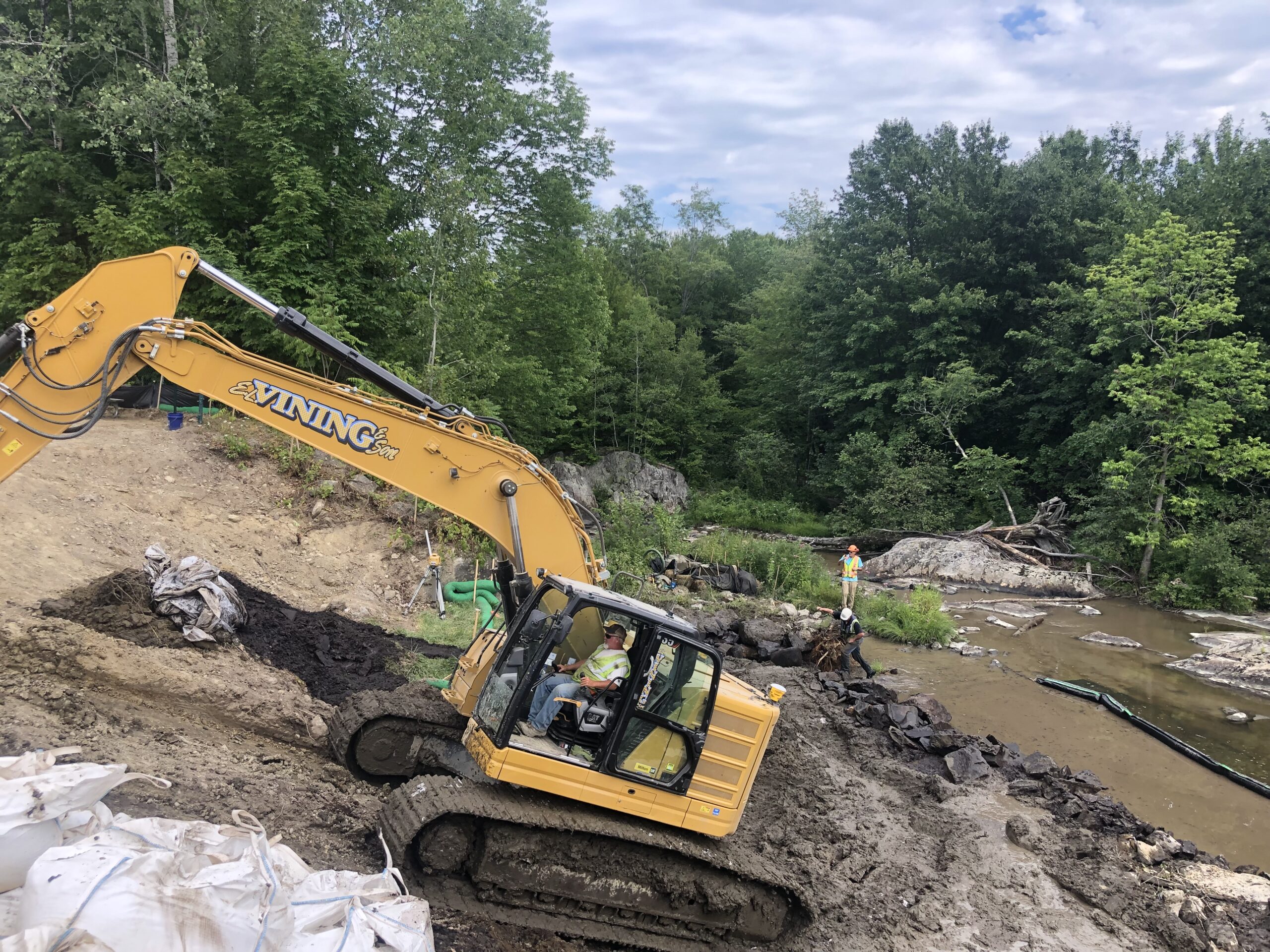
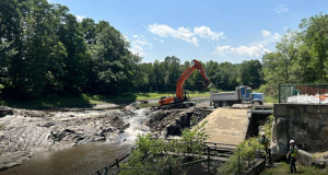
My wish to see a dam removal first-hand recently came true thanks to Maranda Nemeth, the Project Manager overseeing the removal of Walton’s Mill Dam in Farmington, ME. As a part of the Atlantic Salmon Federation, one of Maranda’s major goals is to conserve and restore wild Atlantic salmon and their ecosystems. Walton’s Mill Dam (now almost completely removed) used to sit along Temple Stream, which feeds into the Sandy River and later the Kennebec River. Temple Stream is extremely important as it has the largest contiguous amount of habitat for endangered Atlantic salmon in Maine. Removing the dam, according to Maranda, “opens up nearly 53 miles of stream to the Sandy River.” This would be extremely helpful to Atlantic salmon, which use Maine rivers to spawn. The $3 million dam removal project, however, is not limited to just helping just salmon and related fish and wildlife – it opens up wonderful opportunities for recreation and the preservation of history. The project, supported with major help from the Atlantic Salmon Federation, the National Oceanic and Atmospheric Administration, Maine Department of Environmental Protection, Maine Department of Marine Resources, Maine Natural Areas Program, U.S. Fish & Wildlife Service, and Land and Water Conservation Fund is restoring the park with a new overlook, landscape, and open spaces for the Farmington community to enjoy.
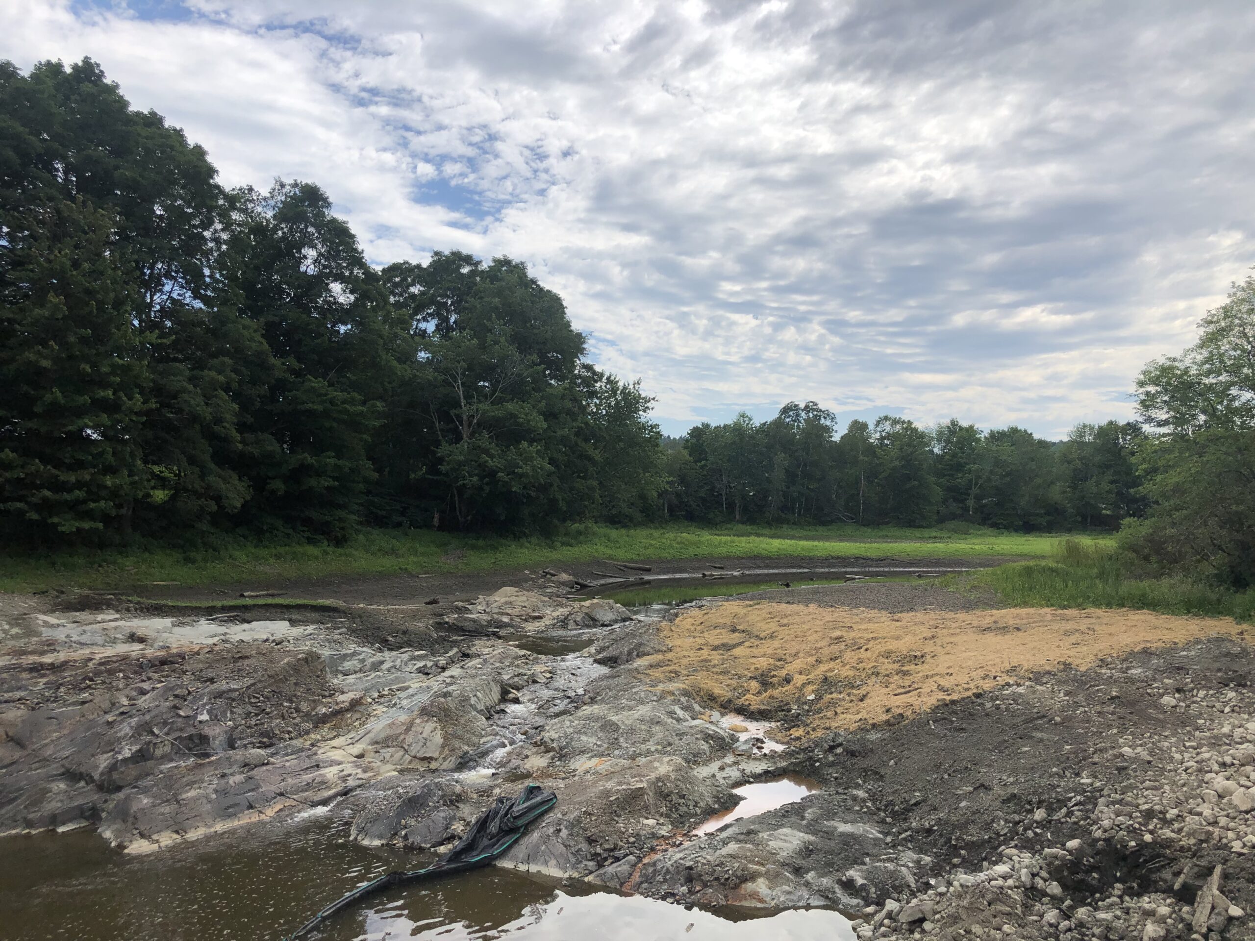
The dam used to sit on the open bedrock shown here. The upstream impoundment is now replaced by bright green vegetation planted by Maranda and her team.
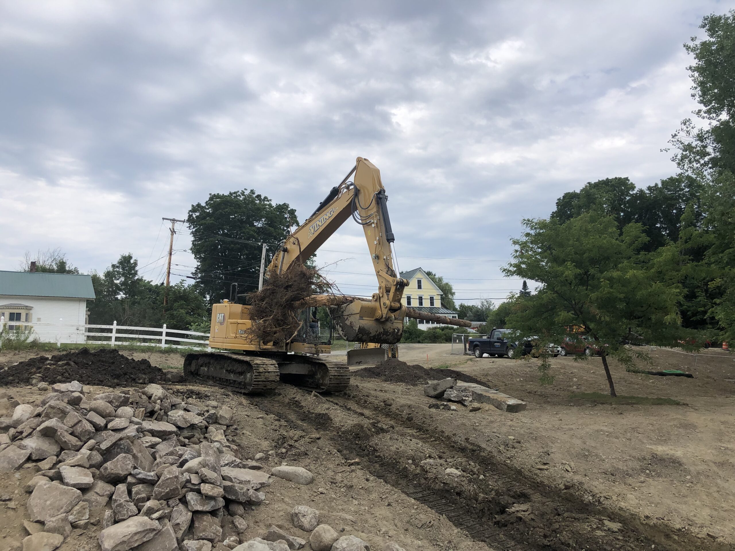
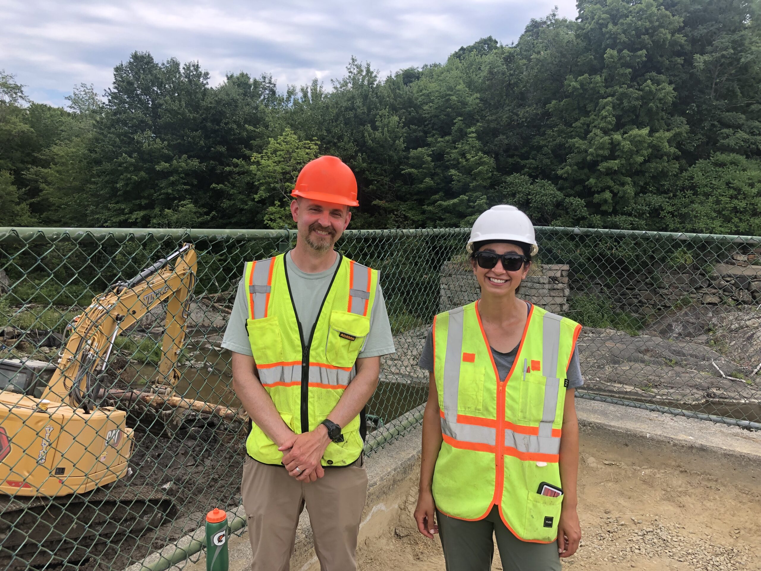
When I arrived at the removal site, I was immediately struck by the sheer size of the operation. Although some may consider the 300 foot dam to be relatively small, the mix of a huge excavator and Maranda’s well-coordinated team moving each and every way really made this appear like quite the operation. Maranda walked me around the site, explaining the complexities of a project like this. Removing the dam meant that the team had to revegetate sizable sections of the upstream impoundment. A diverse mix of plants were used here, each carefully selected from the surrounding environment to ensure that the area can grow back to its natural state. On the downstream side of where the dam had been removed, the team was working to rebuild the river bed to improve sediment flow and facilitate fish migration. This was the aspect of the project I was able to see with my own eyes and, man, was it cool! As we stood and spoke, an excavator carefully moved large stones (which were previously used to build the dam) and old root wads to reconstruct the river bed. While the stones mimic the natural environment of the river, the root wads provide habitat for all sorts of little river creatures to thrive.
A large tree with a root wad being brought down to the river bed.The excavator clawing its way up to collect more material to build the stream bed.
When it comes to climate change, Walton’s Mill Dam removal is extremely significant for two major reasons. Firstly, Maranda as well as Bill, an on the ground figure for the U.S. Fish & Wildlife Service, who I was also fortunate enough to speak with, noted how old dams like these pose significant hazards to the surrounding community when flooding occurs as a result of big storm events. Climate change is beefing up the impacts of these storms and increasing the rate of their occurrence, thus straining key structural components of the dam. If the dam were to collapse, it could damage downstream vegetation, wildlife, and infrastructure. These impacts are saddening and costly. Secondly, according to reports from the USFWS, Walton’s Mill Dam served as an obstruction to some of the coldest waters in the Northeast, environments that are ecologically prized for the health and future viability of various fish and wildlife. As many may know, climate change is contributing to a significant rise in water temperatures, making these environments extremely hard to come by. The removal of the dam is opening up access to these cold water habitats and hopefully providing avenues for fish and wildlife to shelter from climate-related hazards.
Bill and Maranda overlooking the job site.A Climate Change Observatory monitoring post was installed and looks upstream on Temple Stream towards the dam area with the park on the right. The photos captured and integrated into the chronolog time lapse will show the construction activity throughout 2022 and long term, as well as help us document the changes occurring over time (Photo courtesy of Atlantic Salmon Federation).
It was a pleasure to visit the dam removal site. Maranda, thank you so much for the tour!! If you are interested in reading more about the Atlantic Salmon Federation and their work, check out this link.
Outlook explores variables that shape and influence individuals relationships with nature and how they seek to inspire, adapt and reimagine what conservation can look like moving forward in a world where Climate Change is affecting a broad range of human and natural systems.
Author: Chas Van Damme, SMCC Summer Associate. A rising senior at Bates College studying Environmental Studies with a focus in Global Environmental Politics.
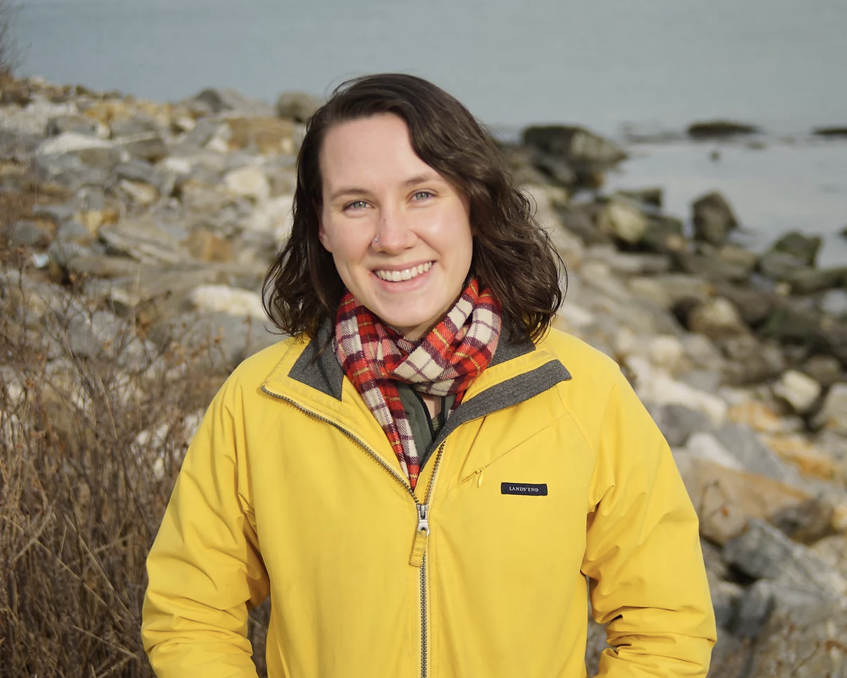
OUTLOOK: A chat with Madeline Tripp, Environmental Resilience Fellow with the Greater Portland Council of Governments, and developer of the Community Intertidal Data Portal.
Madeline Tripp
“We didn’t just want to provide a tool, we wanted people to help create a resource with us.”
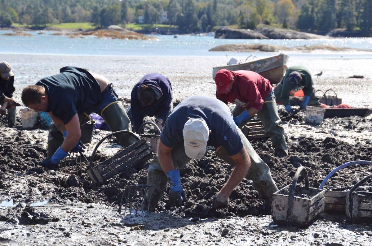
Threaded into the cultural, economic, and ecological fabric of various different communities in the state, the importance of the Maine shellfish industry cannot be understated. The sector has seen a boom in recent years as aquaculture and shellfish harvesting continue to grow more lucrative by the year. In 2021, the oyster industry hauled in 50% more oysters than 2020, according to numbers from the Dept. of Marine Resources. That’s nearly 6 million pounds of oysters harvested in a single year alone! As these industries expand, so does our demand from the sensitive coastlines and intertidal zones that produce coastal resources, opening up vital conversations about how to sustainably manage these nearshore environments. Throw in the complexities brought forth by climate change, sea level rise, development, pollution, etc. and the management plan for these water-loving resources becomes a lot murkier.
Clam diggers in Maine. (Ellsworth American Photo by Jacqueline Weaver)
Perhaps not many people know this better than Madeline Tripp, an Environmental Resilience Fellow with the Greater Portland Council of Governments, who I was fortunate enough to speak with recently. Originally from North Carolina, Madeline has always been fascinated by the intersection between people and the environment, and the ways in which clear, equitable access to data can fashion healthier relationships between the two. With the bulk of her undergrad work focusing on Geography, she’s also somewhat of a genius when it comes to Geographic Information Systems. Although foreign to shellfish management prior to her work in Maine, over the past two years she’s been able to put both her interests, expertise, and contagiously happy character to work by creating an extremely helpful resource for the shellfish industry: the Community Intertidal Data Portal.
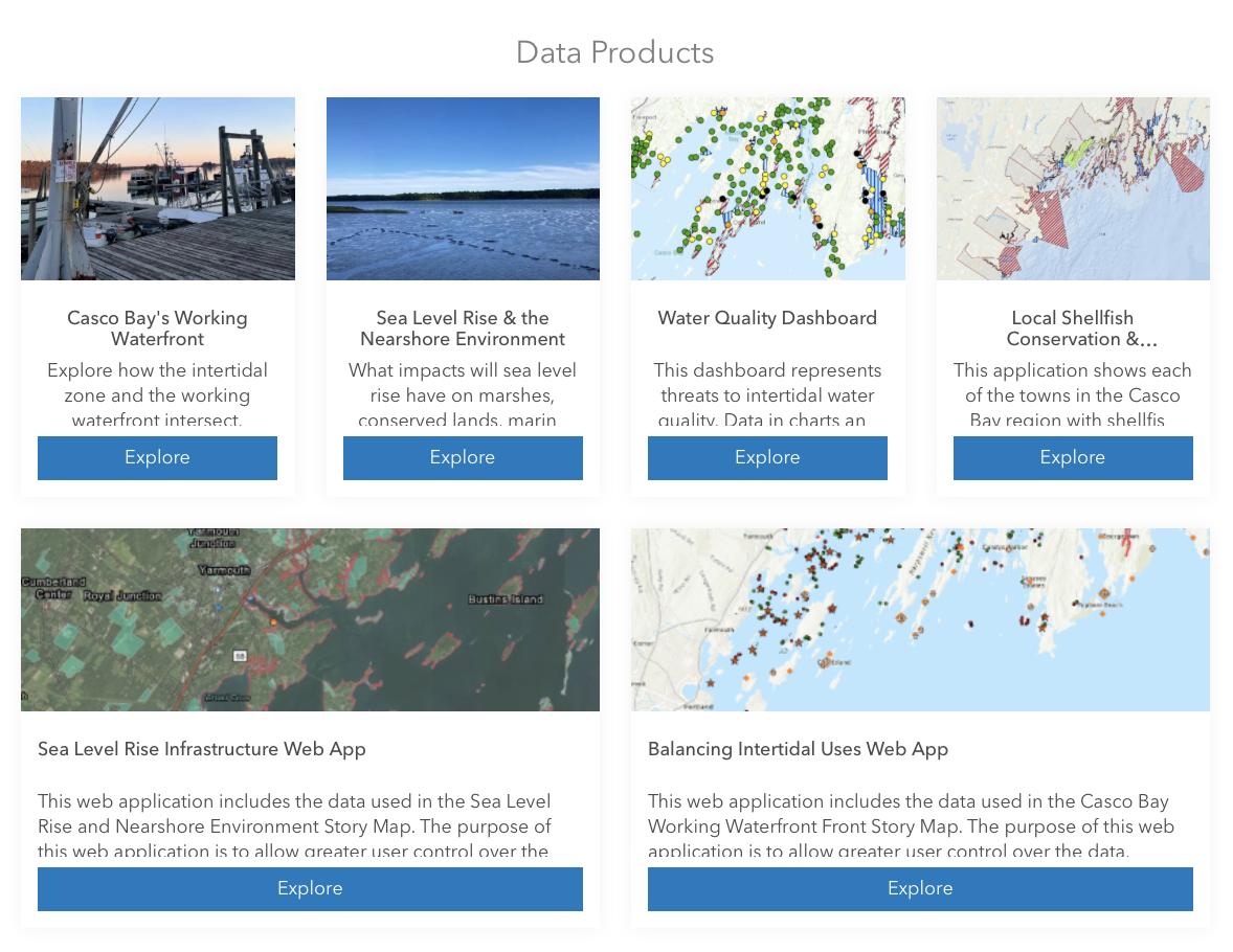
Data from the intertidal zone – the area where the ocean meets the land between high and low tides – has long been decentralized, tangled in the inner webs of public and private sources, and often presented in formats too technical to understand. Be it water quality scores that inform clam flat closures or sea level rise projections needed for municipal resiliency planning, intertidal data is crucial for virtually anyone engaged in the shellfish industry. The Community Intertidal Data Portal has pooled mountains of this data together into several different ArcGIS mapping formats for the everyday user to engage with, ensuring easy access to the information necessary to adopt a more complex understanding of the issues facing coastal environments.
Some of the data products available for public viewing. Each contain a detailed description of their purpose, as well as information about where the data is sourced from. (Community Intertidal Data Portal)
As Madeline and I spoke, she ran me through the development of the portal, which just like seemingly everything else in our lives, also faced the struggles and opportunities presented by the COVID-19 pandemic. Madeline joined the project during its early outreach stage; the portal couldn’t have been created without input from the people intended to use it. Madeline and other hard-working members of the team spent months calling up and chatting with everyone and their mother: town council members, shellfish harvesters, aquaculture stakeholders, researchers, the list goes on. She noted that these conversations, happening in the peak of the pandemic with most folks isolated at home, often lasted hours. It was this aspect of the project she found to be the most meaningful. “We didn’t just want to provide a tool, we wanted people to help create a resource with us.” Outreach conversations allowed the portal’s conception to be collaborative with buy-in from all stakeholders involved.
The mixed bag of climate change, sea level rise, and pollution is simply becoming too much for coastal communities to handle on their own. “We need to stress the importance of sharing information and resources between Maine communities to address these challenges,” Madeline noted. The Community Intertidal Data Portal is a phenomenal start in widening channels of collaboration between communities and I can’t wait to see how the portal grows to help fellow Mainers address all sorts of different coastal challenges.
Outlook explores variables that shape and influence individuals relationships with nature and how they seek to inspire, adapt and reimagine what conservation can look like moving forward in a world where Climate Change is affecting a broad range of human and natural systems.
Author: Chas Van Damme, SMCC Summer Associate. A rising senior at Bates College studying Environmental Studies with a focus in Global Environmental Politics.
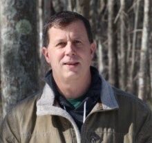
OUTLOOK: An afternoon chat with Bill Stauffer, Vice President of Oceanside Conservation Trust of Casco Bay.
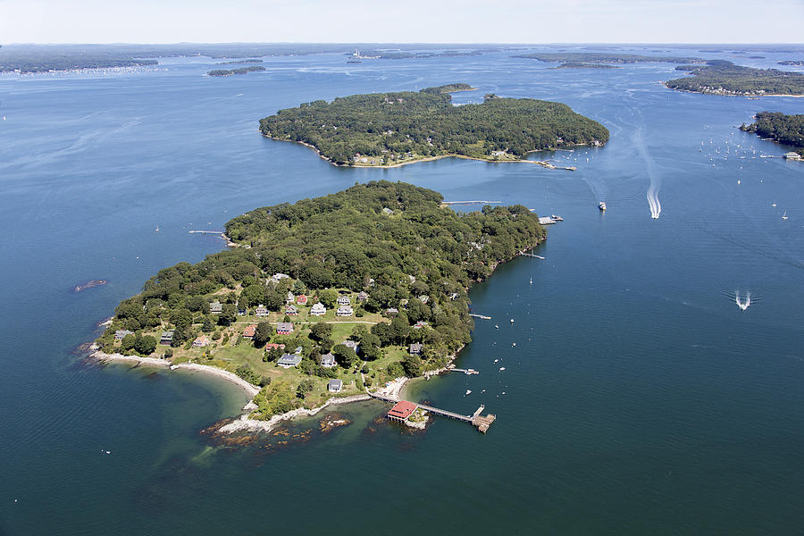
I had the opportunity to sit and chat with Bill Stauffer, Vice President of the Oceanside Conservation Trust of Casco Bay (OCT). As a Colby College alum and one of the lucky few full-time residents on Little Diamond Island, Bill’s roots stretch far and wide throughout the state of Maine – roots that evidently keep him motivated in the effort to protect the landscapes he has known and loved for decades.
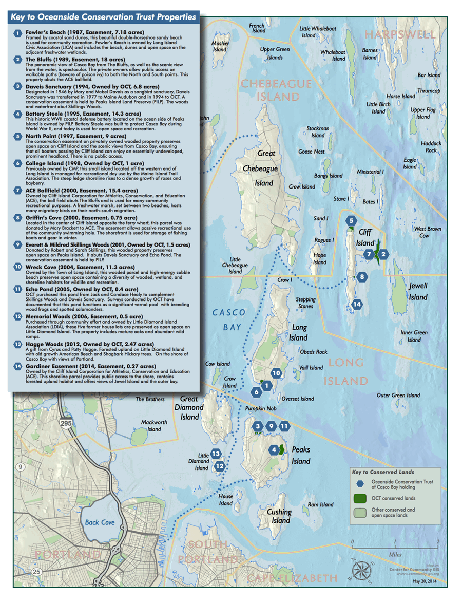
Map of OCT Conserved Lands.
As we spoke, Bill recounted the significant changes he had witnessed in the world of conservation throughout his time with OCT. Roughly twenty years ago, he remembers the amount of conserved land on Little Diamond Island being about an acre. Zoom ahead to today, and nearly 20% of the island is conserved in perpetuity thanks in large part to the hard work and generosity of the OCT community. But that’s just a snapshot. OCT conserves around a 100 acres of extraordinarily important island properties (fee & easements) across several islands in the Casco Bay.
Prized for their importance to migratory birds, various other flora and fauna, as well as their beauty, islands are vital aspects of our ecosystems. Every acre of conserved island land counts. Bill noted the importance of islands as hotspots for climate change research. Due to their geographical separation from mainland territories, islands are often characterized as “natural” spaces”, making them key areas for ecological research focusing on the impacts of human development. OCT is actively monitoring and documenting coastal impacts from climate change on their properties, and is one of many land trusts involved with the Climate Change Observatory Network. OCT has four Climate Change Observatory sites installed on island properties, that encourage and inspire community members and visitors to help monitor, learn, and get involved in climate action.
Little Diamond Island, Casco Bay Photograph by Dave Cleaveland.
In addition to these sites, OCT’s active all volunteer board and stewards are on the ground every year to monitor all of their properties, keeping a keen eye on how the landscapes have changed over time. After their monitoring period this May, Bill mentioned that erosion continues to be a key issue at hand on just about all of OCT’s properties. Ironically, erosion is even threatening the viability of one of the climate change observatory posts they set up a little while back.
“We have witnessed intensified storm surges that erode the banks more every year,” Bill recounted.
Not only is this proving to be a threat to the sensitive ecosystems on the islands, but it is also impacting local residents. In fact, Bill noted that property insurance costs on the island are nearly triple the price one would pay on the mainland. Of course, the cost one might pay depends on several variables, but on average, island residents are paying massive premiums that are only expected to get pricier as climate change intensifies.
Climate change is becoming a burden on our wallets as much as our safety, but let’s not get lost in the thinking that being environmentally friendly comes at a hefty cost. Bill and I both agreed that it does not always have to be. His family, for instance, installed solar panels on their home several years ago, allowing them to generate a large chunk of clean electricity on their own. This change paid off the price of solar panel installation in only a couple of years, allowing them to create energy for free without any reliance on the grid. In fact, with most home installations, folks are able to sell back any excess electricity back to the grid to be shared throughout their community. Pair these installations with electric vehicles and one could also cut out a reliance on high fuel costs. You pay high up-front costs for renewable energy, and that is a major financial barrier of access for many people, but state and federal tax deductions are available for folks to make these changes a little more economical. If you are interested in learning more about these deductions check out this link!
It was a pleasure to chat with such a charismatic person like Bill, and an even bigger privilege to hear about all the truly impactful work he is doing with OCT. Thanks, Bill!
“The project at Walton’s Mill Park in Farmington is successfully underway with the first portion of the Walton’s Mill Dam removed and Temple Stream flowing across the ledge for the first time in 240 years. Once completed, over 54 miles of cold-water habitat will be reconnected for aquatic wildlife and the park will be renovated while preserving the mill history of the site and improving public access.“~ Maranda Nemeth, Maine Headwaters Project Manager, Atlantic Salmon Federation ~
Photo courtesy of Atlantic Salmon Federation (ASF)
The Climate Change Observatory photo monitoring site looks upstream on Temple Stream towards the dam area with the park on the right. The photos captured and integrated into a chronolog time lapse video will show the construction activity throughout 2022 and long term, as well as help document the changes occurring over time along Temple Stream.
Walton’s Mill Park opened to the public in 1980 and is owned by the Town of Farmington. The Park is a special town property that gives visitors a place to explore and connect to history and nature. In 2018, voters in the Town of Farmington approved plans for the dam removal and park improvement work in partnership with Atlantic Salmon Federation. The park will close temporarily and construction will be from June-December 2022 to improve public safety, recreation, and restore the river health.
The Town of Farmington, Atlantic Salmon Federation and U.S. Fish and Wildlife Service are part of the Southern Maine Conservation Collaborative’s Climate Change Observatory Network, a photo monitoring program designed to work with environmental organizations and communities to assist with the observation, measurement and documentation of long-term climate change trends and climate adaptation projects.
Outlook explores variables that shape and influence individuals relationships with nature and how they seek to inspire, adapt and reimagine what conservation can look like moving forward in a world where Climate Change is affecting a broad range of human and natural systems.
Author: Chas Van Damme, SMCC Summer Associate. A rising senior at Bates College studying Environmental Studies with a focus in Global Environmental Politics.
OUTLOOK: An afternoon chat with Margaret Gerber, Director of Stewardship at the Brunswick-Topsham Land Trust.
I recently had the opportunity to meet up with the wonderful Margaret Gerber, Director of Stewardship at the Brunswick-Topsham Land Trust (BTLT). Founded in 1985, BTLT is a nonprofit land trust protecting over 3100 acres of rich natural landscapes throughout the Brunswick and Topsham area. Shaded by the tall pines above us, we sat outside her office in Brunswick to talk about her work in the realm of conservation and what she envisioned the field might look like as the pace of climate change continues to increase throughout this region.
Having previously worked with the Royal River Youth Conservation Corps, Maine Island Trail Association, Maine Coast Heritage Trust, and now BTLT, Margaret has had the unique opportunity to see how conservation has shifted through the years. In her early work in the Conservation Corps, she noted that climate change was not the primary focus that it might be today. Ensuring public access to outdoor spaces for opportunities like recreation filled that role. This focus, however, shifted dramatically in the wake of the IPCC’s early Climate Change Report, which informed us that dangers to our health and way of life were imminent if we did do something. As we spoke, Margaret recalled the exact moment the report came out: she was sitting in her college bedroom alongside her roommate, discussing it as a wave of existential dread filled the room. This period proved to be formative in making conservation essentially her life’s work.
She immediately switched her plans to travel on a semester abroad to New Zealand, opting instead to pursue a sustainability program in Denmark. Her experiences there, a piece of which entailed a trip to research ice recession in Greenland, brought her up close and personal to beautiful, yet equally sensitive natural landscapes. The ice sheets she had seen were (and still are) receding at unprecedented rates, exposing bedrock that hadn’t seen a hint of light for hundreds of years. This was the most visible and tangible exposure she had ever had to climate change, an experience which created what she noted as a “powerfully visceral connection” to the realities of human-induced environmental harm.
As I look through the notes from our talk, I keep coming back to this point. It reminded me of a reading I did a while back about the psychological discrepancy between humans and climate change, particularly in the ways in which we see, feel, and understand environmental hazards. Elise Amel, in their article “Beyond the Roots of Human Inaction,” argue that because humans developed in “a world where dangers were sudden and obvious…our senses are ill equipped to detect largely invisible and gradually worsening ecological problems” (Amel et al. 2017). We aren’t geared to immediately react to manifestations of gradual environmental harm, especially when the impacts of something like climate change appear amorphous and oftentimes invisible.
Perhaps one way to illuminate invisibility is to take influence from Margaret, and help people find the opportunities to see the clear visual evidence of climate change for themselves. Land trusts like BTLT create such opportunities to bring the public into the beautiful and complex ecosystems that surround us. Through their trail networks, workshops, and volunteer opportunities, they help individuals to tap into a reverence for the natural world, while simultaneously exposing them to threats these sensitive environments are facing. Land trusts are not just preserving land in perpetuity, but also protecting the immense educational value that land can provide us. It’s for these reasons that I truly value the profound role that even the smallest of land trusts play in advancing global conservation efforts.
Margaret, thank you so much for taking the time to speak with me. Our conversation opened a lot of boxes in my head, and I hope this piece does something similar for others!
*Amel, Elise, Christie Manning, Britain Scott, and Susan Koger. 2017. “Beyond The Roots Of Human Inaction: Fostering Collective Effort Toward Ecosystem Conservation”. ScienceMag 356 (6335): 275-279. doi:10.1126/science.aal1931.
Outlook explores variables that shape and influence individuals relationships with nature and how they seek to inspire, adapt and reimagine what conservation can look like moving forward in a world where Climate Change is affecting a broad range of human and natural systems.
Author: Chas Van Damme, SMCC Summer Associate. A rising senior at Bates College studying Environmental Studies with a focus in Global Environmental Politics.
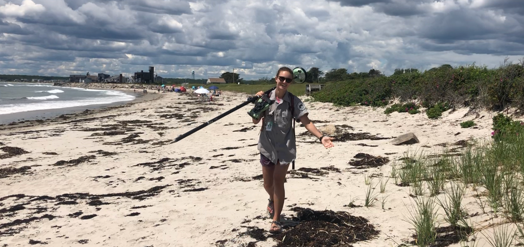
OUTLOOK: An afternoon “WALK & TALK” with Natalie Meenan, beach surveyor with the Maine Geological Survey.
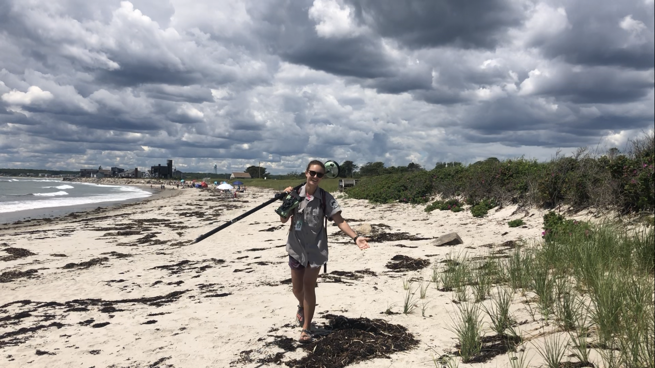
A couple days ago, while droves of seagulls swept around in front of my favorite beach spot, stealthily making a lunch out of what was seemingly some little kid’s cheese sticks, I couldn’t help but dream about what it would be like to bask endlessly under the sun, listening to streams of waves crash against the sandy shoreline. For Natalie Meenan this dream is somewhat of an everyday reality. The important distinction being that she is not basking at all, but instead toting a large GPS contraption across miles of several beaches in Southern Maine as a surveyor with the Maine Geological Survey (MGS).
I recently had the privilege of joining Natalie on one of her surveying days at Fortunes Rock Beach in Biddeford to pick her brain about her work, interests, and thoughts on climate change. Originally from Friday Harbor, Washington, where several years of guiding kayak tours nurtured an appreciation for the outdoors, she now finds herself as far as she could possibly get from home: studying Geology at Bates College in Lewiston, ME. On our walk, she described a pressing need to address the ever-growing impacts of climate change, focusing particularly on the coast where sea level rise and erosion are perhaps most easily visible. It’s this motivation that drew her to work as a coastal intern with the MGS this summer.
As we walked the coastline, Natalie explained the technical aspects of her work. Her (very fancy) GPS system tracks her every movement, logging both the mean high water line and dune line at a given beach. These variables are particularly important in analyzing the changes in coastal environments as they inform research into sea level rise, dune recession, habitat destruction, and much more. When compared with the 15+ years of previous surveying work done on locations like Fortunes Rock, we are able to see just how quickly coastlines are shifting. Every two years, the data that folks like Natalie collect is pooled together and analyzed in MGS’ State of Maine’s Beaches Report, which provides key insight for town and state-level policymakers hoping to remediate the coastal impacts of climate change.
“When it comes to coastal environments like beaches,” Natalie noted, “change is completely natural – dunes will recede, the high water line will fluctuate, and sediment will find itself new homes. What is concerning, however, is that these environments are changing at unprecedented rates.”
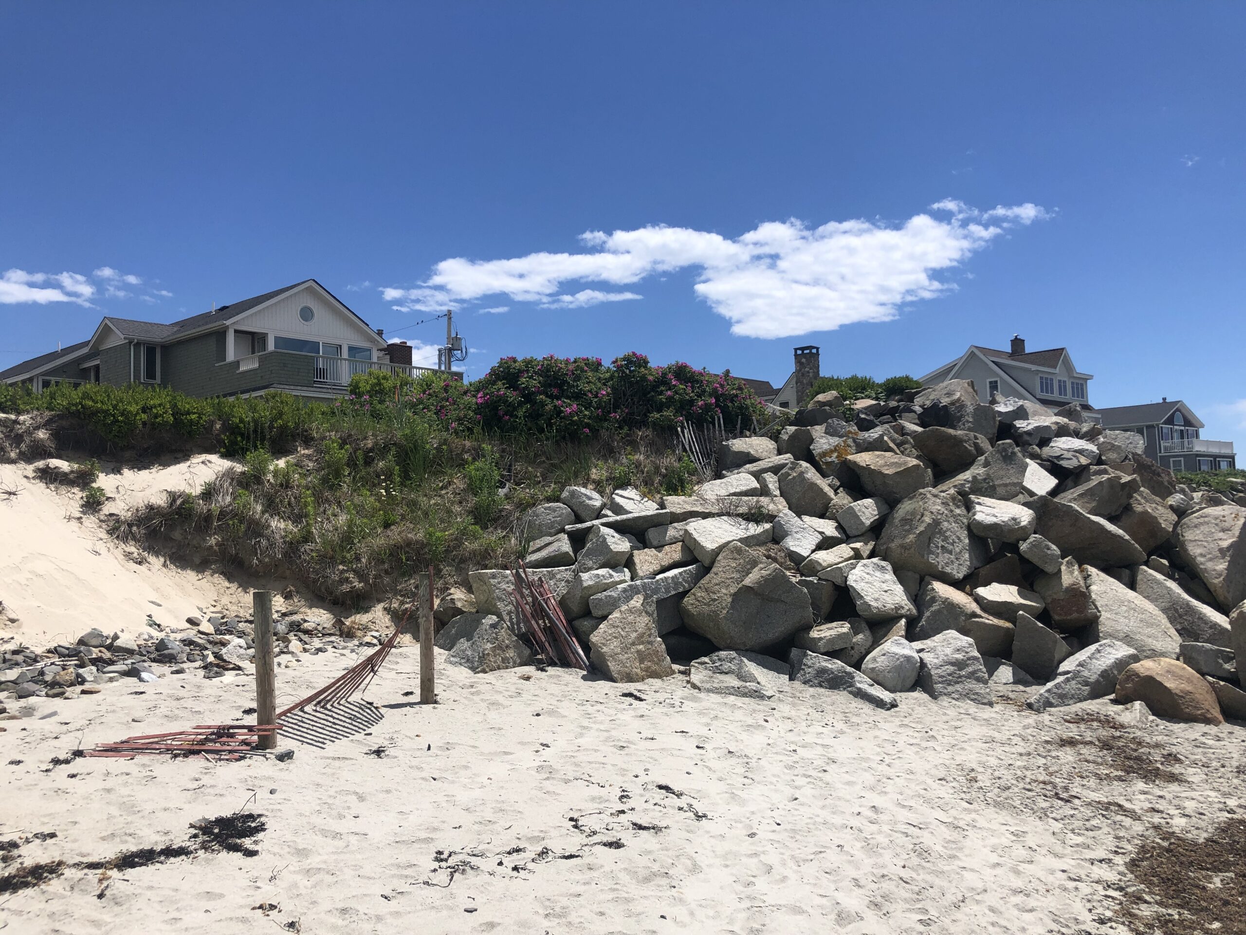
Human-induced climate change is speeding up these processes and sharpening the teeth of their impacts. In response, residents along coastlines are working to adapt to these new realities by building up seawalls, rewilding and reinforcing dunes, and finding ways to protect sensitive areas. As you see below, a few of these attempts were evident at Fortunes Rock.
But to what extent is climate adaptation sustainable? Homes built on beaches will always be subject to gradual natural environmental changes. As these changes grow in scale is adaptation potentially becoming a feat of futility? The large boulders lodged along the northern end of Fortunes Rock Beach might speak to this. For now, they are doing their job of protecting the beautiful homes above them, but the dunes just 10 feet south are continuing to recede. What’s next? Install barriers to protect those dunes? Potentially explore natural erosion-prevention measures such as planting native beach grasses? There is no clear-cut answer. Yet one thing’s for certain: so long as we depend on living along coastlines, adaptation will be an ongoing process requiring new ideas, innovations, and research from hardworking people like Natalie.
Research has always been foundational in the pursuit of climate resolution – a concept that the Climate Change Observatory Network is no stranger to. Natalie and I noted that the presence of a Climate Change Observatory site in places like Fortunes Rock could facilitate the documentation of coastal changes. By pooling a series of photographs of a given location over a long period of time, these sites provide a visual repository of change. When seen in tandem with the data collected by people like Natalie, CCO sites would help guide us on the steps toward climate resilience.
I am thankful to Natalie for allowing me the time to join her on such a lovely expedition, even if it meant pestering her with too many questions!
 Madeline Tripp, Environmental Resilience Fellow with the Greater Portland Council of Governments, is on the other end of the research that Bill wishes to facilitate. As the developer of the Community Intertidal Data Portal, Madeline committed herself to pooling research data, particularly shellfish data from the intertidal zone, into formats that are more easily accessible to everyday users. It’s through this work that Madeline plays her own role in confronting climate change. She mentioned in our talk that tackling climate change must be rooted in collaborative processes, “We need to stress the importance of sharing information and resources between Maine communities.”
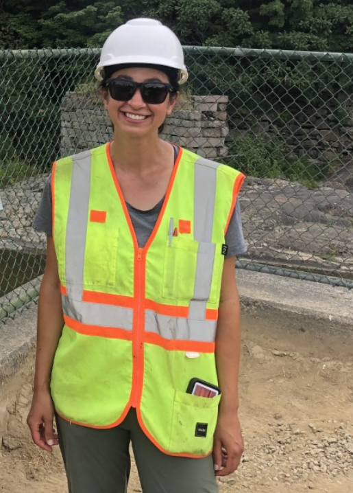
